No to Army Helicopter Training up Icicle
- Concerned Citizens of Icicle Valley/Leavenworth
- Target:
- usarmy.jblm.imcom.list.dpw-eis@mail.mil
- Region:
- United States of America
- Website:
- www.lewis-mcchord.army.mil
Concerns in response to a "Notice of Public Scoping" published in the July 2015 edition of the Leavenworth echo by the Department of the Army, directorate of Public works, Environmental Division concerning a "Northwest aviation operations off-base helicopter training area" which would include an approximate three and a half acres in the proximity of Icicle Ridge. Public input period ends July 30, 2015.
"Training operations would be conducted using aircraft to include the MH/UH-60 Black Hawk, AH-64 Apache, and MH/CH-47 Chinook. The training areas would be available for use day and night, 24 hours a day, 365 days a year, with the exception of Federal Holidays."
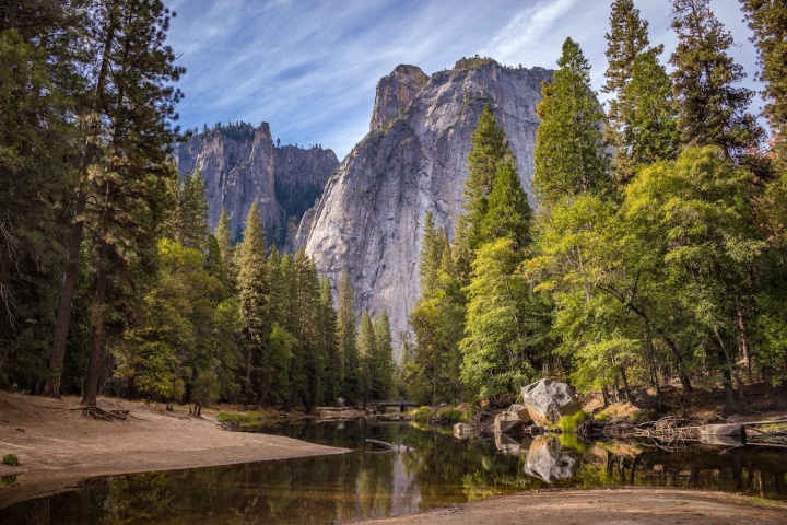
Proposed Helicopter Landing Zone of concern to Icicle/Leavenworth:
MTA (mountain Training Area) 1-4
N47 38.21 W120 50.46 Latitude/use Longitude
7676 ft
3.6 acres
4.2.2 Mountain Training Area
Within the proposed MTA, helicopters would perform various mission-essential tasks that involve performance planning, power management, and high-altitude flight techniques used to compensate for the decreased aircraft performance at high altitude. Pilots would fly at high altitudes and land at designated high-altitude HLZs using varying angles of approach, headings, air speeds, under both day and night conditions (using infrared lights), to reach proficiency for the following tasks:
• VMC takeoff.
• VMC approach (typically 10 degrees) to a landing or to a 3-ft hover.
• Abort and go-around procedures –
• Elevated (100-500 ft [30-152 m]) reconnaissance over high-altitude HLZs.
• Slope operations – landing operations performed on an angled, uneven surface.
• Pinnacle or ridgeline operations – landing operations performed on a pinnacle, or a formation similar to a pinnacle
Proposed Helicopter Landing Zone of concern to Icicle/Leavenworth:
MTA (mountain Training Area) 1-4
N47 38.21 W120 50.46 Latitude/use Longitude
7676 ft
3.6 acres
We the undersigned hereby petition against the use of the Icicle Ridge area for a
proposed 3.6 acre Mountain Army Helicopter Training/Landing Zone at N47 38.21 W120 50.46 Latitude/use Longitude, 7676 ft.
Excerpt from Army web site, "Training operations would be conducted using aircraft to include the MH/UH-60 Black Hawk, AH-64 Apache, and MH/CH-47 Chinook. The training areas would be available for use day and night, 24 hours a day, 365 days a year, with the exception of Federal Holidays."
For full disclosure paste the following web address into your browser:
http://www.lewis-mcchord.army.mil/publicworks/docs/envir/EIA/HTA/Final%20Scoping%20Document%20-%20JBLM%20HTA%20Submittal%2025Jun15.pdf
A "public scoping period" is a democratic vetting process established by the government to seek out information prior to a designated undertaking, such as use of public land.
This process helps them determine compatibility and best understand how the issue may affect citizens. In this case they have established the possibility of a series of helicopter training sites on a topographic map and are now gathering information to decide upon appropriate locations. The army selected spots based on their projected needs and is now fact gathering and learning about their surroundings. This is where you come in.
Your input is not indicative to whether or not you support the military budget, engagements or any other political point. Simply, is the Icicle the best spot in the state for a military helicopter tactical training site?
You can further help this campaign by sponsoring it
The No to Army Helicopter Training up Icicle petition to usarmy.jblm.imcom.list.dpw-eis@mail.mil was written by Concerned Citizens of Icicle Valley/Leavenworth and is in the category Environment at GoPetition.